iTopoMaps 7.2
Continue to app
Paid Version
Publisher Description
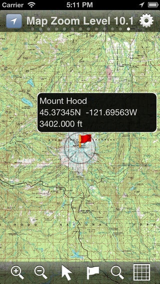
Hikers and climbers can now access real full-resolution USGS topographic 1:24k quads with side-scrolling multi-zoom map capabilities. In addition, quads can be graphically selected for storage on the device for access where you need it most, away from cellular and WiFi coverage! Current Map and GPS positions are available in latitude/longitude and UTM coordinate systems. NAD27 and NAD83 are supported. Available Map Sources: USGS (United States and borders) Toporama (Canada) OpenCycleMap (World) OpenStreetMap (World) 11 Zoom Levels are available to give full resolution quadrangles. Simply pinch to zoom in or out! Get in close for details, or zoom out to see your whole area! Select quadrangles graphically just by double-tapping! No need to mess with coordinates or obscure quadrangle names. GNIS (Geographic Names Information Service) database included for Features of Interest lookup. Lookup features (summits, waterfalls, streams, etc) and add them as waypoints! No need to type in waypoints by hand. You can also search the database in an area and it will label all local features. ~700k entries available at the touch of a finger! All 50 United States States included. Features: - Full Resolution 1:24k USGS Quads (1:63k in Alaska) - UTM and latitude/longitude - Meters and Feet - NAD27 and NAD83 datums - Cache maps on your phone! - Display and record Tracks - Editable Waypoints - Just tap to place or lookup by name. - Course and Speed - Bearing / Distance to Waypoints - Magnetic Declination Calculations - Map works in portrait and landscape positions! - GPS Location and Map following - Look up GNIS locations from geographic formations (like Summits, Streams, Falls, Cliffs, etc) and add them as Waypoints. Have iTopoMaps label neighboring features! When in Grid Mode, simply double tap an area to select a quad for download! Downloads happen in the background and can be restarted where you left out! Wifi/3G recommended for Quad downloads. GPS is not required for map usage, but adds to navigation functionality. New feature requests are always welcome! Join us at http://www.itopomaps.com Some map data is provided by 3rd parties. Availability and coverage are not guaranteed. Tags: GPS USGS Topo Topographics Quads Quadrangles WGS WGS84 UTM Waypoints Tracks GNIS Geographic declination
Requires iOS 5.1.1 or later. Compatible with iPhone, iPad, and iPod touch.
About iTopoMaps
iTopoMaps is a paid app for iOS published in the Recreation list of apps, part of Home & Hobby.
The company that develops iTopoMaps is Amphibious Technologies, LLC. The latest version released by its developer is 7.2.
To install iTopoMaps on your iOS device, just click the green Continue To App button above to start the installation process. The app is listed on our website since 2009-03-27 and was downloaded 5 times. We have already checked if the download link is safe, however for your own protection we recommend that you scan the downloaded app with your antivirus. Your antivirus may detect the iTopoMaps as malware if the download link is broken.
How to install iTopoMaps on your iOS device:
- Click on the Continue To App button on our website. This will redirect you to the App Store.
- Once the iTopoMaps is shown in the iTunes listing of your iOS device, you can start its download and installation. Tap on the GET button to the right of the app to start downloading it.
- If you are not logged-in the iOS appstore app, you'll be prompted for your your Apple ID and/or password.
- After iTopoMaps is downloaded, you'll see an INSTALL button to the right. Tap on it to start the actual installation of the iOS app.
- Once installation is finished you can tap on the OPEN button to start it. Its icon will also be added to your device home screen.
